


Navajo & Apache Counties PUMA, Arizona
About
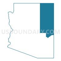
Outline

Summary
| Unique Area Identifier | 192163 |
| Name | Navajo & Apache Counties PUMA |
| State | Arizona |
| Area (square miles) | 21,178.16 |
| Land Area (square miles) | 21,147.94 |
| Water Area (square miles) | 30.21 |
| % of Land Area | 99.86 |
| % of Water Area | 0.14 |
| Latitude of the Internal Point | 35.38778210 |
| Longtitude of the Internal Point | -109.88046750 |
Maps
Graphs
Select a template below for downloading or customizing gragh for Navajo & Apache Counties PUMA, Arizona


Neighbors
Neighoring Public Use Microdata Area (by Name) Neighboring Public Use Microdata Area on the Map
- Coconino County--Flagstaff City PUMA, AZ
- Gila, Graham, Greenlee & Pinal (East) Counties PUMA, AZ
- La Plata, Montezuma, Gunnison, Archuleta, Dolores, Hinsdale & San Juan Counties PUMA, CO
- Northwest New Mexico--Navajo Nation PUMA, NM
- Southeast Utah & Uintah Basin Region PUMA, UT
- Southwest New Mexico PUMA, NM
Top 10 Neighboring County (by Population) Neighboring County on the Map
- Coconino County, AZ (134,421)
- San Juan County, NM (130,044)
- Navajo County, AZ (107,449)
- Apache County, AZ (71,518)
- McKinley County, NM (71,492)
- Gila County, AZ (53,597)
- Graham County, AZ (37,220)
- Cibola County, NM (27,213)
- Montezuma County, CO (25,535)
- San Juan County, UT (14,746)
Top 10 Neighboring County Subdivision (by Population) Neighboring County Subdivision on the Map
- Flagstaff CCD, Coconino County, AZ (89,754)
- Snowflake CCD, Navajo County, AZ (46,905)
- Tuba City CCD, Coconino County, AZ (31,639)
- Red Rock CCD, McKinley County, NM (24,280)
- Fort Defiance CCD, Apache County, AZ (23,325)
- Chinle CCD, Apache County, AZ (20,896)
- Winslow-Holbrook CCD, Navajo County, AZ (18,068)
- Shiprock-Sanostee CCD, San Juan County, NM (16,634)
- Fort Apache CCD, Navajo County, AZ (11,176)
- Kayenta CCD, Navajo County, AZ (10,159)
Top 10 Neighboring Place (by Population) Neighboring Place on the Map
- Show Low city, AZ (10,660)
- Winslow city, AZ (9,655)
- Snowflake town, AZ (5,590)
- Kayenta CDP, AZ (5,189)
- Holbrook city, AZ (5,053)
- Eagar town, AZ (4,885)
- Chinle CDP, AZ (4,518)
- Pinetop-Lakeside town, AZ (4,282)
- Taylor town, AZ (4,112)
- Whiteriver CDP, AZ (4,104)
Top 10 Neighboring Elementary School District (by Population) Neighboring Elementary School District on the Map
- Solomon Elementary District, AZ (2,883)
- Concho Elementary District, AZ (2,475)
- Vernon Elementary District, AZ (1,932)
- Chevelon Butte School District, AZ (650)
- McNary Elementary District, AZ (549)
- Alpine Elementary District, AZ (463)
- Eagle Elementary District, AZ (37)
- Blue Elementary District, AZ (37)
Top 10 Neighboring Unified School District (by Population) Neighboring Unified School District on the Map
- Flagstaff Unified District, AZ (91,658)
- School District Not Defined, AZ (69,809)
- Gallup-Mckinley County Schools, NM (63,611)
- Central Consolidated Schools, NM (33,082)
- Grants-Cibola County Schools, NM (27,088)
- Chinle Unified District, AZ (20,202)
- Montezuma-Cortez School District RE-1, CO (18,573)
- Safford Unified District, AZ (16,677)
- Show Low Unified District, AZ (16,295)
- Tuba City Unified District, AZ (16,064)
Top 10 Neighboring State Legislative District Lower Chamber (by Population) Neighboring State Legislative District Lower Chamber on the Map
- State House District 1, AZ (217,022)
- State House District 5, AZ (192,258)
- State House District 2, AZ (177,904)
- State House District 58, CO (78,435)
- State House District 69, UT (31,813)
- State House District 49, NM (31,024)
- State House District 4, NM (28,107)
- State House District 6, NM (27,357)
- State House District 9, NM (26,110)
Top 10 Neighboring State Legislative District Upper Chamber (by Population) Neighboring State Legislative District Upper Chamber on the Map
- State Senate District 1, AZ (217,022)
- State Senate District 5, AZ (192,258)
- State Senate District 2, AZ (177,904)
- State Senate District 6, CO (144,787)
- State Senate District 27, UT (93,972)
- State Senate District 4, NM (43,917)
- State Senate District 28, NM (43,562)
- State Senate District 3, NM (41,208)
Top 10 Neighboring 111th Congressional District (by Population) Neighboring 111th Congressional District on the Map
- Congressional District 2, AZ (972,839)
- Congressional District 2, UT (890,993)
- Congressional District 1, AZ (774,310)
- Congressional District 3, CO (706,186)
- Congressional District 3, NM (693,284)
- Congressional District 2, NM (663,956)
Top 10 Neighboring Census Tract (by Population) Neighboring Census Tract on the Map
- Census Tract 9443, Apache County, AZ (6,958)
- Census Tract 9747, Cibola County, NM (6,660)
- Census Tract 9617, Navajo County, AZ (6,323)
- Census Tract 9438, McKinley County, NM (6,253)
- Census Tract 9440, Apache County, AZ (6,043)
- Census Tract 9441, Apache County, AZ (5,870)
- Census Tract 9427, Apache County, AZ (5,628)
- Census Tract 9404, Gila County, AZ (5,288)
- Census Tract 9425, Navajo County, AZ (5,281)
- Census Tract 9705.01, Apache County, AZ (5,081)
Top 10 Neighboring 5-Digit ZIP Code Tabulation Area (by Population) Neighboring 5-Digit ZIP Code Tabulation Area on the Map
- 87301, NM (23,674)
- 85901, AZ (17,207)
- 86047, AZ (14,970)
- 87420, NM (11,967)
- 86045, AZ (11,354)
- 86503, AZ (10,714)
- 85941, AZ (9,941)
- 85929, AZ (8,322)
- 87327, NM (7,883)
- 86033, AZ (7,844)